Posts

Showing posts with the label Mojave National Preserve

Wind Project To Be Crammed In Amidst Wilderness and Wildlife

Image
Sweden-based company Eolus is reviving plans to build the Crescent Peak Wind project in southern Nevada on wildlands prized for wildlife and primitive recreation.  Basin & Range Watch learned that the company filed initial paperwork with the Bureau of Land Management (BLM) to begin environmental review of the project. This photo was taken along the northeastern boundary of the Wee Thump Joshua Tree Wilderness Area. The Crescent Peak area is in the distance on the right, and would be covered in giant wind turbines if Eolus gets its way. Solitude or Industrial Zone? Eolus is targeting a patchwork of unprotected lands in the Piute Valley that the BLM acknowledges are ideal for primitive recreation, and surrounded by conservation and wilderness designations. The Piute Valley offers a “range of outdoor recreation activities associated with a wide-open landscape with limited developments,” according to the BLM's own draft resource management plan. The Piute Valley is roug

What are you doing on Tuesday?

Image
Now is our moment to protect public access to desert wildlands for future generations to enjoy.   Tuesday is an important opportunity to tell government officials that we cherish the vast open landscapes that the California desert has to offer.  Our presence will send a message that we are tired of losing public lands to private, for-profit destruction.  At stake will be the White House's consideration of the Mojave Trails, Castle Mountains and Sand-to-Snow National Monuments.  Without these monuments, our desert will transition from a humbling, natural landscape to an industrial checkerboard.  The desert that early inhabitants experienced was a lot more expansive than the desert we know today, and if we don't take action now, our grandchildren will inherit a landscape unrecognizable to us and preserved only in our photographs.  Since 2009, dozens of square miles of our desert wildlands have been bulldozed and converted into energy projects and subdivisions. The alternati

Are You Kidding?: Interior Set to Approve Project Near Soda Mountain

Image
The Department of Interior released its final environmental impact statement for Bechtel's Soda Mountain Solar project and appears to abandon previous " landscape-level " planning.  The document signals imminent approval for the nearly three square mile project that could ironically make it more difficult for desert bighorn sheep to adapt to climate change and imperil an endangered desert fish, ignoring alternative locations for the solar panels on rooftops or already-disturbed lands. According to the environmental review, the desert habitat that will be destroyed to make way for the Soda Mountain Solar project currently hosts as many as 142 different species of native plants, 13 reptile species, and 15 mammal species, including three species of bats that forage on the site.  Fifty-one different bird species have been documented using the habitat, including burrowing owls.  Biologists found 50 recently active owl burrows on the project site. Confidence Rests on Da

Celebrating the Desert Protection Act

Image
Senator Dianne Feinstein's California Desert Protection Act (CDPA) was signed into law 20 years ago on October 31, 1994, establishing new protections for vast stretches of the desert.  The CDPA established 69 new Wilderness areas,  created the Mojave National Preserve, converted Death Valley and Joshua Tree National Monuments into National Parks, and added acreage to both parks. Watching the sun set in a remote corner of the Mojave forges a connection between me and generations past, and it would be nice to know that future generations will share the same natural heritage.  Witnessing mountain shadows gently stretch across miles of open desert, hearing coyotes howl at twilight as bats flutter by, and being immersed in an infinite blanket of stars overhead are some of the treasured experiences you can have in the desert.  Clouds stroll across the sky during the midday in the Mojave National Preserve, casting shadows on the mountains and valley. These experiences are incre

Nevada: Draft Plan Would Endanger Natural Treasures

Image
The Bureau of Land Management (BLM) put forward a draft resource management plan (RMP) for southern Nevada that ignores opportunities to protect lands with wilderness characteristics and proposes industrial-scale energy development near natural landmarks.  The draft RMP adds to the extraordinary burden that desert activists face as they comb through the Desert Renewable Energy Conservation Plan for neighboring California; comparing the two plans highlights how bureaucratic boundaries can result in arbitrary differences in how we manage desert wildlands. Wildlands Sidelined The RMP acknowledges that an inventory of desert habitat identified over 378 square miles of land with wilderness characteristics - sufficient size, naturalness, and outstanding opportunities for either solitude or primitive and unconfined recreation - that could be managed to preserve these attributes. However, the preferred alternative would only protect about 15% of these lands. This area in t

BLM Reviewing Route 66 Management in California

Image
Route 66 is an important artery providing access to California's Mojave Desert.  Like the two-lane  " Outback Highway " that runs mostly north/south through the region, Route 66 provides east/west access to stunning desert vistas still mostly unharmed by man, giving visitors a chance to share a common experience with past generations.  The Bureau of Land Management (BLM) and California Historic Route 66 Association are now developing a Corridor Management Plan (CMP) that seeks to align county and Federal efforts to protect this historically significant corridor.  A map from the California Historic Route 66 Association website shows the portion of the Route 66 corridor that will be reviewed for the Corridor Management Plan.  From Needles to just west of Barstow is about 160 miles of history, culture, and beautiful desert scenery. I am excited about the potential for the CMP to make a visit to the California Desert a richer experience, with more opportunities for fo

Bridges for Bighorn

Image
Despite efforts to protect desert habitat in the southwest, major highways criss-crossing the desert are isolating wildlife into smaller pockets and hindering genetic exchange necessary to keep species healthy and resilient.  Desert bighorn sheep are not exempt from this impact; they may be agile and swift, but they are no match for several lanes of speeding cars and semi-trucks, and they tend to shy away from culverts that cross under highways. Biologists have already noticed that desert bighorn sheep populations in the Mojave and Colorado Deserts are becoming genetically isolated because the region's major highways - such as Interstate 15 and Interstate 40 - and other human developments pose a barrier to sheep movement from one range to another.  According to a 2005 article in Ecology Letters ,  biologists found "a rapid reduction in genetic diversity (up to 15%)" among desert bighorn sheep resulting from "as few as 40 years of anthropogenic isolation. Interstat

Wildlife Viewing at the Preserve this Weekend

Image
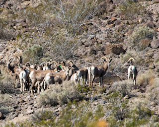
If you are free on Saturday, June 7, head out to the Mojave National Preserve for an opportunity to learn from wildlife experts and a chance to see bighorn sheep and other desert denizens.   I had the fortune of visiting the Desert Studies Center at Zzyzx last month, and the even greater fortune of viewing desert bighorn sheep along the rocky slopes that meet the Soda Dry Lake.  Although the landscape is mostly dry, natural springs in the area provide a critical water source for the sheep and habitat for the endangered Mohave tui chub.  I would highly recommend heading out to this event early, and consider camping in the Preserve that night if you want to prolong your escape into the desert! These bighorn sheep were photographed just above the Desert Studies Center, which lies in the Mojave National Preserve at Zzyzx. 

The Future of Zzyzx: Solar Project or Wildlife?

Image
Here we go again.  Do we allow Bechtel to destroy 3.8 square miles of desert habitat, or keep the wildlands intact to preserve a potential wildlife corridor?  Bechtel's proposed 350 megawatt Soda Mountain Solar project could dry up habitat for an endangered desert fish, and foreclose an opportunity to restore bighorn sheep habitat connectivity.  The Bureau of Land Management (BLM) published a draft environmental impact statement that signals likely approval for the Soda Mountain  project, although environmental groups , former National Park superintendents , and other citizens are expressing concern regarding the BLM's environmental review.  Prospects for wildlife are dim, however;  BLM also ignored wildlife concerns and environmental group protests when they approved the Stateline and Silver State South Solar projects in the Ivanpah Valley , a critical desert tortoise habitat linkage.  A judge denied a preliminary request from Defenders of Wildlife to stop the Ivanpah projec

Desert Tortoises Love Thunderstorms

Image
Desert Tortoises spend the vast majority of their lives underground in the coolness of their burrows.  In the cool hours of the morning or evening they may come out to browse the vegetation.  They will also be lured outside during thunderstorms to visit spots where they know the water will form puddles.  These are the times to exercise the most caution when you're on the road. This adult tortoise was spotted in the middle of the road in the Mojave National Preserve about an hour after a thunderstorm passed through.  It was moved safely to the shoulder of the road.  It's difficult to spot tortoises when speeding along, especially since their low profile and color blends in with the road. This female desert tortoise was sunning herself on a dirt road in the Mojave National Preserve near Kelso Dunes.  She later found refuge in the shade of a desert plant. If you come across a tortoise, do not disturb it.  But if you find it in the middle of a well traveled road whe

Desert Tortoise Photo Exhibit

The Kelso Depot in the Mojave National Preserve is hosting a photo exhibit featuring pictures taken by high school students of desert tortoises in the Mojave.  The exhibit runs from early May until 7 August, so you still have a couple of weeks left to check it out. Info: Tortoises Through the Lens:  A Conservation Exhibition by Mojave Desert Students May 2 - August 7, 2010 Kelso Depot Visitor Center, Mojave National Preserve

Woodland

Image
Joshua Tree woodland in the Mojave National Preserve

Name that Bird part Two

Image
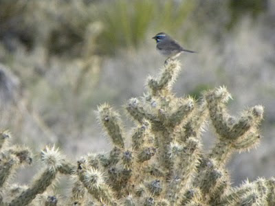
I'm posting a couple more photos of the unidentified bird from my previous post to see if it helps anyone in their identification of the species.   One commenter suggested that it perhaps could have been a black-throated gray warbler.  I'm no expert so I could not completely discard this possibility, but the images online for the warbler show more distinct black and white patterns than the bird in my photo, which is mostly gray with the only visible patter being the blue and white streaks by the eyes.   Welcome more comments/ideas.

Name that Bird

Image
If you have any guesses as to what species of bird is perched on the cholla cactus in the picture below, feel free to leave a comment.  I got a picture of it from a distance, but I'm not sure what species of bird I captured in the photo.  The photo was taken in the western Mojave National Preserve.  Note the streaks of blue and white by its eyes.

The Sunset Glow of the Cholla Cactus

Image
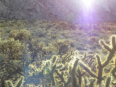
I got these shots of cholla cactus near the Granite Hills in the Mojave National Preserve practically glowing as the sun set, which provided a back light to their needles.

Threatened Vistas

Image
Among the Mojave Desert treasures at stake as energy companies lay claim to vast tracts of BLM-managed desert wilderness are relatively unspoiled scenic vistas.  The view below was taken at dusk in the protected Mojave National Preserve.  Only a stretch of the lonely Kelbaker Road is visible in the distance and leading off to the west of creosote scrub and lava flows.  The California Desert Protection Act of 2010 , introduced by Senator Diane Feinstein, could help preserve more Mojave treasures before they are bulldozed by improperly sited industrial-scale energy development.  In the meantime, it is up to the California Energy Commission (CEC) and science-based surveys of Mojave and Colorado Desert resources to prevent the "solar rush" from trampling irreplaceable wilderness and wildlife.

Mojave camping trip part 2: Cima to Granite Hills

Image
Picking up on my previous post covering my late March camping trip in the Mojave National Preserve, I last left you as we came off Aiken Mine Road, turning onto Cima Road.  For those that have visited the Preserve in the past, you'll know that the Teutonia Peak is one of the most popular hikes on Cima Road.  I had already hiked the peak during a previous trip, so we continued on down Cima Road en route to Kelso Depot for a refreshment before we scouted out a camping site.  It's always impressive to see the Joshua Tree woodland in the Cima dome area.  Where I grew up in Victorville the Joshua Trees are thicker, more robust and probably taller (on average), but much more sparse than in Cima.  The trees in Cima are thinner and shorter, but obviously the ecosystem fits the "woodland" description quite well!  I was excited when we got to Kelso Depot and we spotted the first desert dandelion.  I know, it's kind of nerdy, but I have not seen a desert dandelion in

Mojave Camping Trip part 1: Kelbaker to Cima

Image
Just getting around to giving a read-out on my late March camping trip in the Mojave National Preserve.   We started out with a drive to the lava cinder cones in the western portion of the preserve. Lots of shrubs blooming along the road, and some wildflowers here and there.  Plenty of greenery on the desert floor amidst the lava flows and the cacti looked fresh and ready for the spring. The lava tube is definitely worth checking out.  It's just a short walk from Aiken Mine Road.  The rough cinder walls of the tube are broken in spots at the top, allowing a flood of light to enter. The cinder cone area is scattered with creosote and Yucca, with some ephemeral washes coursing through the lava flows. You can see in the picture above that the sky was clear, although that came at a cost.  Plenty of wind across the Preserve that day.    After the lava tube we continued East on Aiken Mine Road -- a dirt road that connects Kelbaker Road and Cima Road.  If you check out, go slow and s