West Mojave Plan Would Expand OHV Route Network
The Bureau of Land Management (BLM) in February released a
Supplemental Environmental Impact Statement (EIS) for the West Mojave Plan that would expand the open route network for off-highway vehicle (OHV) use and limit livestock grazing. Despite concerns that an earlier iteration of the plan's OHV route network would have a significant adverse effect on wildlife, this draft proposes to significantly expand authorized OHV access to 10,428 miles of routes. For the sake of comparison, the City of Los Angeles alone has about 6,500 miles of
paved roads.
The last iteration of the West Mojave Plan was finalized in 2006 and proposed to designate 5,098 miles of open routes, but a
Federal judge ordered the BLM to revise the plan. The court ruled that the original plan lacked sufficient analysis of the effects of OHV
use and grazing on wildlife, and asked the BLM to evaluate alternative OHV route networks that would minimize conflict and avoid considerable adverse effects on soil, wildlife and cultural resources.
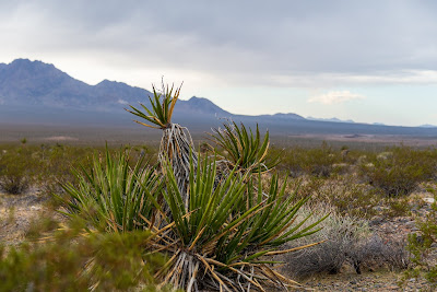
 |
| A wash southwest of Ridgecrest known to support Mohave ground squirrel and desert tortoise. The El Paso Mountains can be seen in the distance. |
The court also asked the BLM to update its baseline inventory of existing routes (both authorized and unauthorized). The public expressed concern that the BLM's original assessment of 8,000 miles of existing routes underestimated the amount of illegal new routes carved by OHV riders not following open routes. In response, the BLM took another look at the West Mojave using high resolution satellite imagery and found approximately 15,000 miles of authorized and illegal routes carved into the West Mojave - far more than the BLM had originally thought existed.
Miles of existing routes inventoried in 2001: approximately 8,000 miles
Miles of open route designated in the 2006 West Mojave Plan: 5,098
Miles of existing routes inventoried in 2012: approximately 15,00
Miles proposed as open routes in the 2015 supplemental EIS: 10,428
Despite public concern that the smaller open route network would itself have adverse impacts on wildlife, the BLM is now proposing to more than double the miles of authorized routes in its 2015 supplemental EIS. Although every fan of the desert relies on open routes to access our favorite corners of this beautiful region, there is a careful balance that needs to be struck between access, recreation, and protecting the integrity of our wildlands. The plan would create areas where the concentration of open routes combined with the high frequency of OHV use would encourage a pattern of erosion and vegetation loss that could threaten the viability of wildlife habitat over time. Specifically, a significant portion of the proposed open routes occur between the Golden Valley and El Paso
Mountains Wilderness areas, which serves as important habitat for the
Mohave ground squirrel and desert tortoise. Each route eliminates desert vegetation, and reduces forage and cover available to animals.
 |
| A screen shot of the open route network map for a portion of the West Mojave Plan area near Ridgecrest, California. The open routes are designated in green, with a significant concentration between the Golden Valley and El Paso Mountains Wilderness Areas. |
Perhaps the impacts of the route network could be manageable if every OHV rider stayed on designated routes, but the impacts are likely to expand with unauthorized route creation. Without proper education and enforcement, riders sometimes add to the network by departing from authorized routes and carving new tracks across the desert. Once a track is carved into the desert soil, it is unlikely to disappear for years. Other riders may see and follow the track, assuming it is part of an open network. The repeat OHV travel on the illegal track increases the damage, and makes it all the more difficult to conceal from other OHV riders.
 |
| A hill south of Ridgecrest scarred by multiple OHV routes. Over time, the loss of topsoil contributes to erosion and prevents vegetation from growing. As routes become impassable, OHV riders sometimes carve new routes, further expanding erosion and loss of vegetation. |
The BLM is accepting comments on the draft supplemental EIS until June 4, 2015, and has indicated that it may revise the open route network based on specific comments from the public.


Comments
Post a Comment