Posts

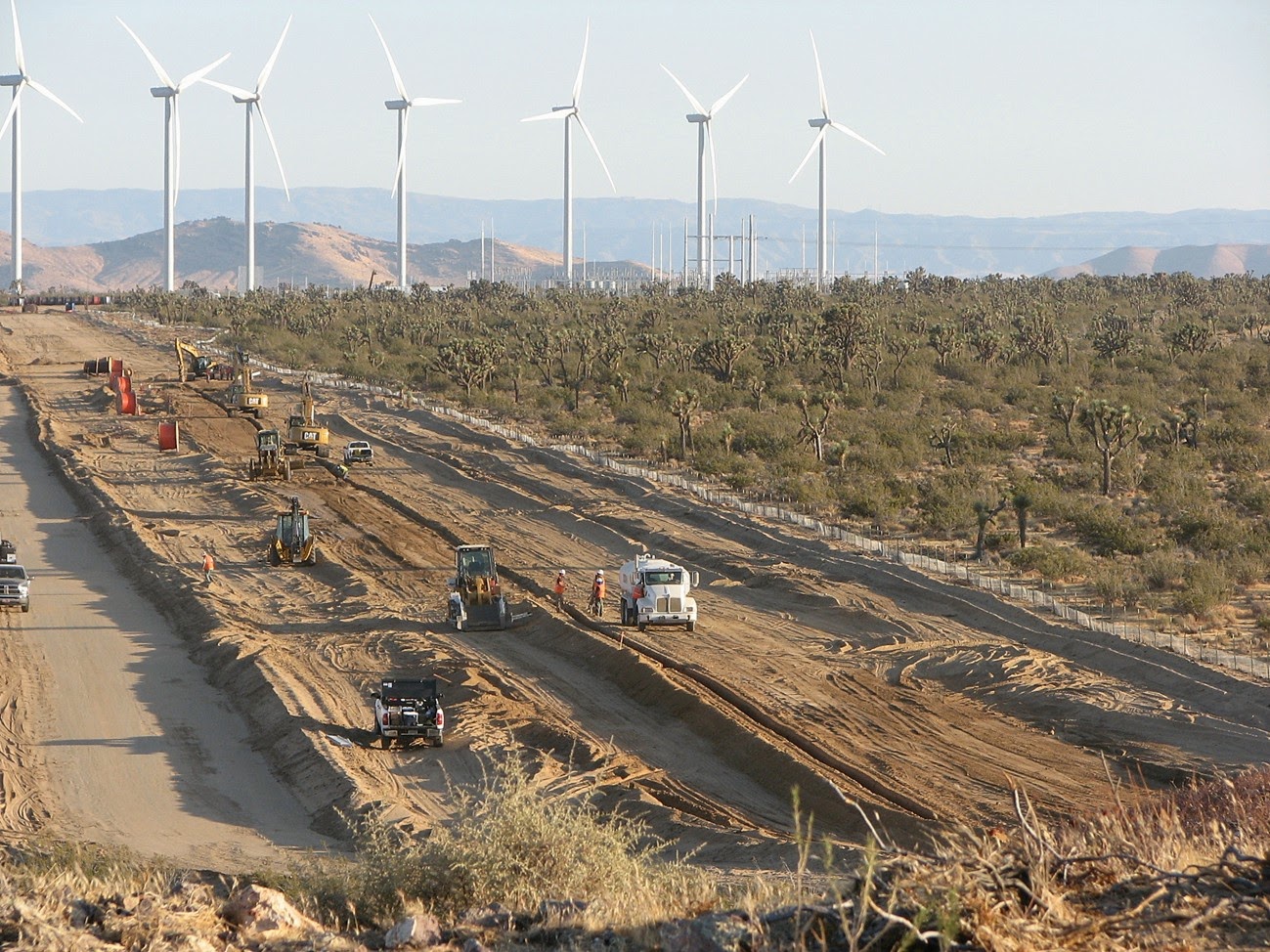
Juniper Flats Safe For Now

Image
Activists in the Lucerne and Victor Valleys received good news from the BLM this past week that plans for the North Peak Wind project had been withdrawn.  The project would have industrialized  nearly 16 square miles of a popular outdoor recreation area known as Juniper Flats popular for hiking and horseback riding, where desert habitat transitions from creosote and yucca scrub to chapparal, grassland and desert conifer.  Groups such as the Alliance for Desert Preservation and Mojave Communities Conservation Collaborative quickly organized to protect Juniper Flats, as well as to challenge the proposed Coolwater-Lugo Transmission project , which is still pending. The hills in the background would have been carved up by wide access roads to reach newly installed wind turbines, which would have towered over the subtle peaks and erased the sense of peace and solitude that visitors find when visiting Juniper Flats. Although it is not yet clear why the company withdrew the wind p

Nevada: Draft Plan Would Endanger Natural Treasures

Image
The Bureau of Land Management (BLM) put forward a draft resource management plan (RMP) for southern Nevada that ignores opportunities to protect lands with wilderness characteristics and proposes industrial-scale energy development near natural landmarks.  The draft RMP adds to the extraordinary burden that desert activists face as they comb through the Desert Renewable Energy Conservation Plan for neighboring California; comparing the two plans highlights how bureaucratic boundaries can result in arbitrary differences in how we manage desert wildlands. Wildlands Sidelined The RMP acknowledges that an inventory of desert habitat identified over 378 square miles of land with wilderness characteristics - sufficient size, naturalness, and outstanding opportunities for either solitude or primitive and unconfined recreation - that could be managed to preserve these attributes. However, the preferred alternative would only protect about 15% of these lands. This area in t

DRECP Spotlight: Conservation Designations

Image
My last couple of Spotlights focused on how the Desert Renewable Energy Conservation Plan designates areas where large-scale renewable energy projects will be considered and fast-tracked, including development focus areas (DFAs), special analysis areas, and future assessment areas.  In an attempt to balance this destruction with conservation, the DRECP also identifies lands to be protected from various forms of destruction.  The types of DRECP conservation designations for lands in the California desert vary depending on whether the land is administered by the Bureau of Land Management (BLM) or private (non-federal). BLM Conservation Designations While the DRECP bestows conservation designations on some key BLM lands in the California desert,  the designations may not be very durable because they can be lifted in a future revision of a BLM land use plan.   This is particularly troubling because the projects built on DFAs will leave their mark on the landscape and ecosystem for

DRECP Spotlight: Development Focus Areas

Image
The draft Desert Renewable Energy Conservation Plan identifies 2,024,000 acres (3,162 square miles) of "development focus areas" (DFA) in the preferred alternative.  Of that total, 367,000 acres (573 square miles) are on lands administered by the Bureau of Land Management (BLM).  I wrote yesterday about the assumptions that were used to come up with this many acres of DFAs. DFAs By County: The following numbers include a both private and BLM-administered lands.  Imperial County shoulders the heaviest DFA burden at 734,000 acres (1,146 square miles), followed by San Bernardino County at 399,000 acres (623 square miles), Kern County at 360,000 acres (562 square miles), Riverside County at 268,000 acres (418 square miles), Los Angeles County at 218,000 acres (340 square miles), and Inyo County at 45,000 acres (70 square miles). Construction crews bulldozing Joshua tree woodland habitat in Kern County to make way for a wind energy facility.  Most of the wind facili

DRECP Fact of the Day: 20,000 Megawatts

Image
This is an important number in the Desert Renewable Energy Conservation Plan (DRECP).  The State and Federal agencies that drafted the DRECP start with the assumption that the California desert region may need to host at least 20,000 megawatts of large-scale wind, solar or geothermal energy projects by the year 2040.  Based on this assumption, the DRECP agencies calculated how many acres would need to be designated as development focus areas (DFAs) to accommodate these 20,000 megawatts. This is what the DRECP does not mention: a study by the UCLA's Luskin Center for Innovation calculated that the rooftops in Los Angeles County alone could accommodate over 22,000 megawatts of solar panels.   As I pointed out in my earlier post on the DRECP, the plan unfortunately discarded an alternative that would consist only of distributed generation (solar panels on rooftops, over parking lots, and other spaces in our cities).   The DRECP's purpose and need statement ( Volume I.1 ) m

DRECP Fact of the Day: Eagles

Image
Golden eagles soar over the Mojave Desert. We know that wind turbines and golden eagles do not mix well.  Solar power towers - like those that BrightSource and NRG built in the Ivanpah Valley - can burn eagles alive.  And sprawling photovoltaic solar plants can destroy the wildlands where golden eagles like to forage for food.   The U.S. Fish and Wildlife Service (FWS) is responsible for monitoring the status of the golden eagle, and determining whether or not any industry - including the renewable energy industry - is permitted to "take" (harass or kill) golden eagles.  (Note: the golden eagle is not an endangered species, but it is protected under the Bald and Golden Eagle Protection Act ) A golden eagle recovering from an injury at the High Desert Museum in Bend, Oregon.  These birds face a number of threats from humans, including climate change, power lines, strikes with vehicles, and wind turbines. According to Appendix H of the Desert Renewable Energy Conservat

DRECP: First Impressions

The draft Desert Renewable Energy Conservation Plan (DRECP) was released at the end of September, almost 34 years after the Department of Interior finalized its original plan for managing the vast and beautiful California Desert Conservation Area.  With nearly 8,000 pages and extensive reformulation of land use policies throughout 22 million acres of California, the DRECP will take a while to digest and formulate thorough comments.  This plan will shape the future of one of the largest intact ecosystems remaining in the lower 48 United States, so it will be worth the time to review and provide input. By the Numbers - Energy Industrialization 3,146 square miles:  The number of square miles of "Development Focus Areas" (DFA) designated by Federal and State agencies in the preferred alternative where large-scale wind, solar, and geothermal energy development will be encouraged or fast-tracked.   Although it is important to note that the DRECP does not anticipate that ever