Panorama Photos of Solar Energy Study Areas Available
As many of you are probably already aware, the Federal Government is proposing Solar Energy study areas, whereby the government has designated areas throughout the southwestern United States to evaluate for the suitability of future solar energy development. The upside to this program is that it would ideally encourage energy companies to consolidate development in specific areas rather than scattered all throughout the Mojave Desert, although the jury is still out regarding the environmental impact on the specific sites chosen by the Federal Government.
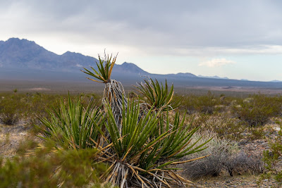
You can visit the website for the Solar Energy Development Programmatic Environmental Impact Statement (EIS) here, and you can also view panoramic photos of the sites being evaluated here. If you check out the photographs for Pisgah, California, you'll see plenty of old lava flows, which will most likely host the endangered Mojave Desert Fringe-toed lizard. That said, the site is located near agricultural fields and not far from populated areas. You can read an update I posted late last year regarding the SES Solar One proposed development which is located in the Pisgah area here. There has not been much movement on the SES Solar One proposal in the California Energy Commission Review process since December.
Below is a screen capture of the map depicting the locations under Federal review in California, which you can also find on the Solar Energy Development Programmatic EIS website. The study areas in California cover approximately 351,000 acres.


Comments
Post a Comment